Location: Woodside, San Mateo County
Hike Date: 2017, August 12, Wednesday, 10:00 am
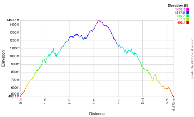
Hike Stats: 6.27 miles, 2.5 hours, 1247 feet
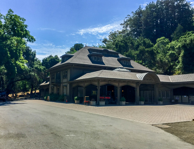
 “Wunderlich Park is a hillside area of redwood forest, open meadows, and beautiful oaks and madrones. This area was donated to the County by Martin Wunderlich. It contains what was once the Folger family ranch, and the estate stable and surrounding buildings have been restored to provide a historic treasure to the community.” (text source: smcgov)
FEATURES
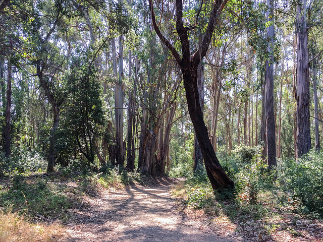
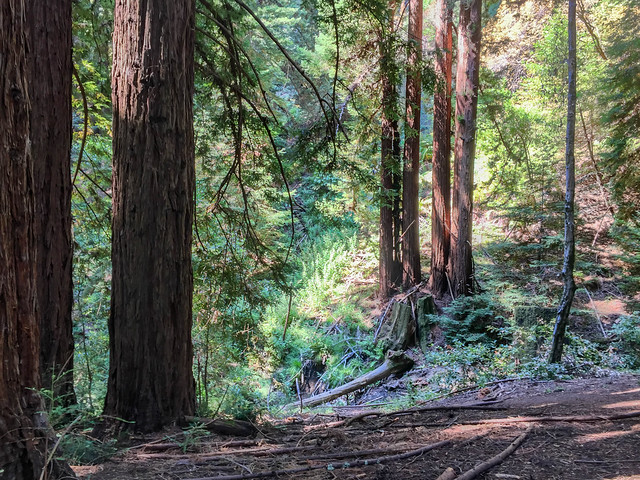
- Redwood, oak, and madrone forest
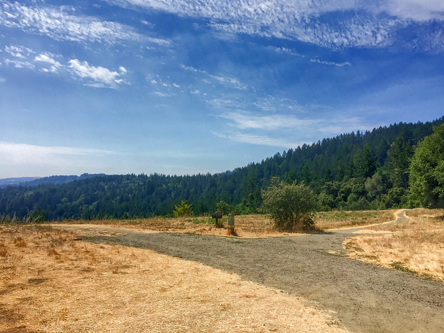
- Open meadow
- Alambique Creek
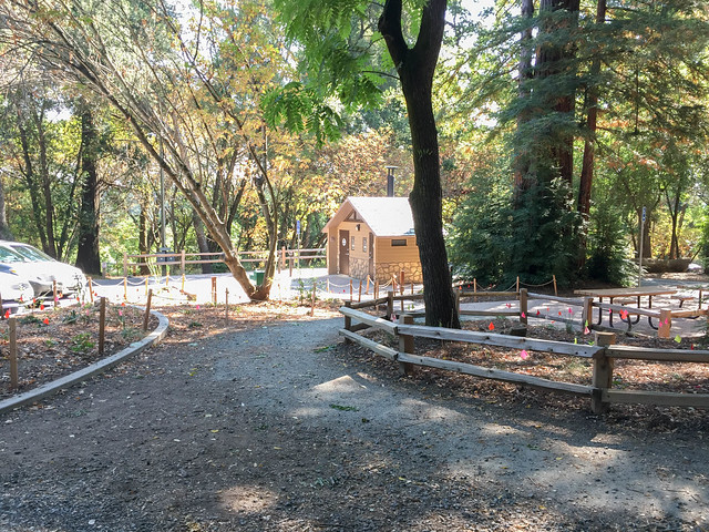
- Folger family (of Folgers Coffee fame) stable near the park entrance
- Carriage Room Museum
ABOUT THE HIKE
Like the previous week, I went for this hike with the San Jose Mid-Week Hiker’s meetup group. I met a few people again from last week’s hike to Huddart Park. A good number of 17 hikers turned up for this one. There were no rest stops.
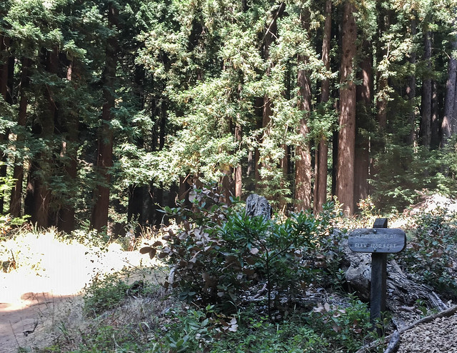
This park has five destination points, all of which have benches. We visited the following four:
- Salamander Flat
- Alambique Flat (near the Alambique Creek)
- The Meadows
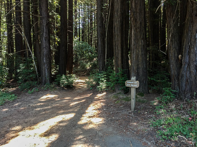
- Redwood Flat
Overall, I did not find this park as shaded as the Huddart Park; a lot of sunlight was able to filter through the tree canopies. The fact that we were hiking on the hottest day (90 F) of the week did not help at all. And then there was the open meadow region we had to hike, though thankfully, it was for a very short distance. The trails littered with horse shit was another slightly annoying thing. But of course, what can you expect from a place that houses a stable and offers equestrian facilities.
Here is a link to the park’s official website. An interesting account of the park’s history is narrated here. Huddart and Wunderlich are both San Mateo’s county parks and have characteristic trail markers.
- Parking Lot: Parking Lot, limited parking spots
- Parking Fee: None
- Restroom: Two, both next to the parking lot
- Trailhead: For the Bear Gulch Trail (close to the parking lot)
- Exposure: Equal parts shaded and exposed
- Route (An 8-loop: first quarter anti-clockwise, second half clockwise, last quarter clockwise):
- Fork at the trailhead (A) –> Take the trail to the right, Bear Gulch Trail (B)
- At the first four-way junction, stay on the Bear Gulch Trail (B)
- Left at the second four-way junction –> Madrone Trail (C) –> ‘Salamander Flat’
- Left at the T-junction –> Redwood Trail (D) (this section of the Redwood Trail is common to the two halves of the 8-loop and is repeated on the way back)
- Right at the T-junction –> Meadow Trail (E)
- Left at the fork –> Oak Trail (F)
- Left at the T-junction –> Alambique Trail (G) –> ‘Alambique Flat’
- Retrace steps on Alambique Trail (G) –> stay left on Alambique Trail
- Right at the T-junction –> Bear Gulch Trail (H) –> ‘The Meadows’
- Stay on Bear Gulch Trail (H) –> ‘Redwood Flat’
- Right to Redwood Trail (I) –> reach junction with Madrone Trail (D) –> stay on Redwood Trail (D)
- Left at the T-junction –> Meadow Trail (J)
- Left at the T-junction –> Alambique Trail (K)
- Left at the fork –> Loop Trail (L)
- Straight at the four-way junction –> Service Rd Trail (M)
- Route Map:
- Terrain Profile:

HIKE STATS
- Distance: 6.27 miles
- Time: 2 hours 30 minutes (Moving Time: 2 hours 21 minutes)
- Avg Moving Pace: 22:36 min/mi
- Elevation Gain: 1247 feet
- Elevation Profile:
SHOTS FROm THE HIKE


Lovved reading this thank you