After moving to Berlin, I went through five stages of grief when I painfully discovered that boneless chicken thighs are not available in the supermarkets here (things you get used to living in the Bay Area/US).
1/9 @BerlinStation showed up on a random search for “Berlin” on Netflix, and it turned out to be an amazing spy thriller (spinning stories around CIA station based out of Berlin)!
2/9 @sandipb and I are ecstatic that even with our short time in this city, we were able to identify so many now-familiar places and understand references to ‘the meeting is at so and so’ street (strasse) and neighborhood.
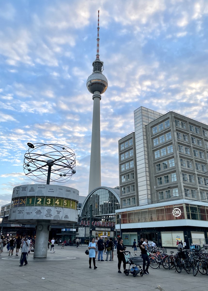
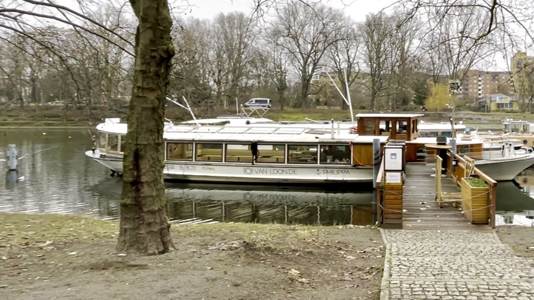
3/9 We’ve just been lucky to have lived close to first the Alexanderplatz (with the famous Berlin TV Tower (Fernsehturm)), then the Landwehrkanal (spotted a lunch scene on the Van Loon Restaurant Boat), and now the Berlin Central Station (Haupbahnhof/Hbf).
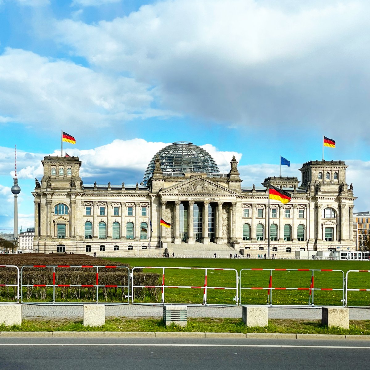
4/9 Hbf – being at the center of the city, at least in terms of public transport connections – is close to a lot of prime buildings and attractions in Berlin. Like the Parliament (Reichstag) Building. And the Brandenburg Gate (Brandenburger Tor).
5/9 The Pariser Platz at the Brandenburg Gate houses a lot of embassies and so is very important in the show to depict cross-country diplomatic relations.
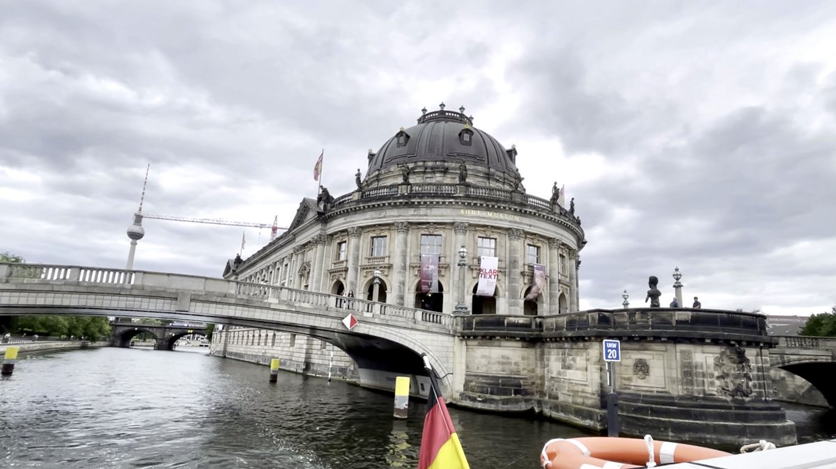
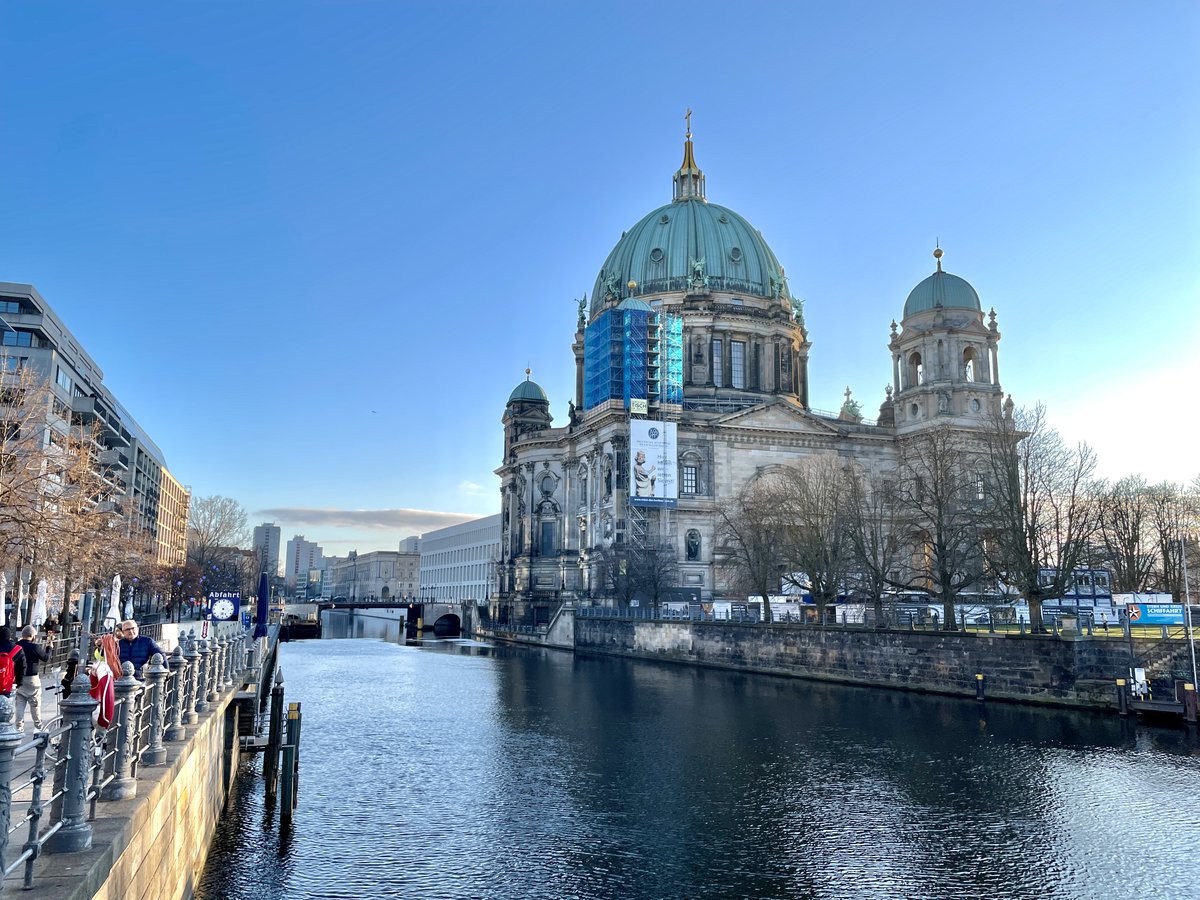
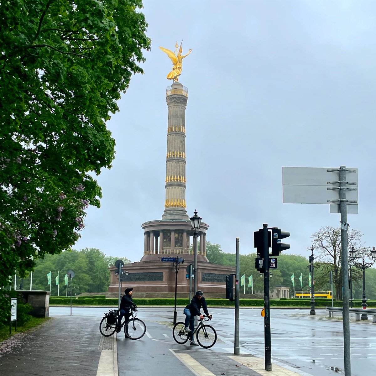
6/9 The Museum Island (Museumsinsel), Berlin Cathedral (Berliner Dom), and the Victory Column (Siegessäule) are pretty accessible and close to us – all landmarks that provide picturesque backdrops in the show and add the quintessential Berlin identity.
7/9 The river Spree happens to run close to Hbf, ensuring a lot of prime shots. We practically go to Hbf every weekend, either to walk across to Spree or to commute or to just grab a coffee/bite.
8/9 The best freakish moment in the show was when I identified a grocery store in the adjoining neighborhood Moabit from their vegetable lineup outside! I had just been at the store two weeks back!!
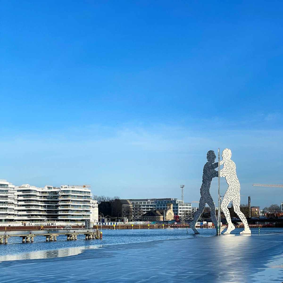
9/9 Also spotted in the show – Oberbaumbrücke, Molecule Man, Invaliden Park, Moabit, Arminius Markthalle, Moabit Prison Historical Park, Bode Museum, Humboldthain Park, and the murals on building facades all over the city
Here are answers to some of the questions I had while trying to understand how I, as an English, non-German speaker, could best use public transport in Berlin. This article currently focuses on options around the city center.
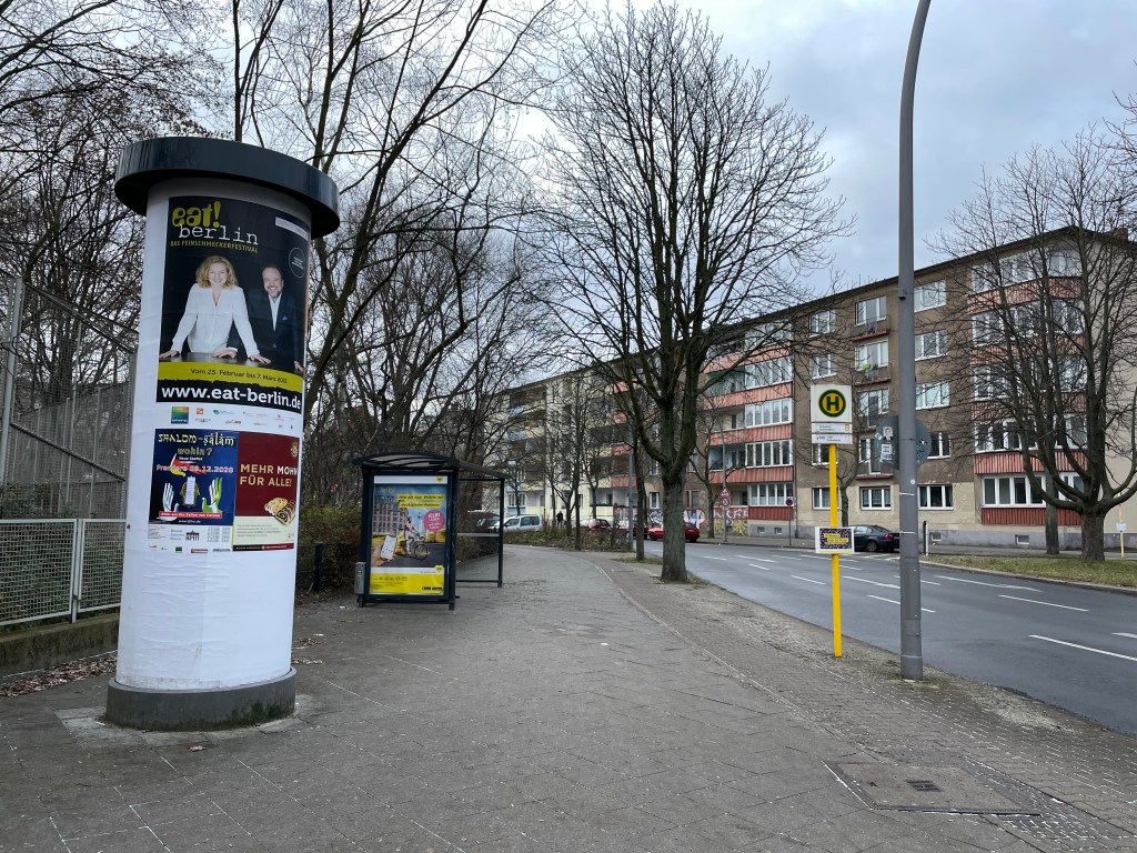
U-Bahn Station sign on the ground level and the stairs that take you underground to the station platform “Haltestelle“, the bus stop
There are three zones in Berlin to determine ticket fares: A (center), B (between A and city boundary), C (outskirts)
The term “Ring” /S-Bahn Ring / Ringbahn describes the region around Zone A, the central part of Berlin, where S-Bahn connects with other S- and U-Bahn lines.
The S-Bahn covers 27 stations along the Ringbahn and takes 60 minutes to complete one round. Lines S41 and S42 form the Rignbahn: S41 moves clockwise and S42 moves anticlockwise.
– Public transport provider – Maintains bus and trams lines – U-Bahn is operated by BVG and is part of VBB.
VBB
Verkehrsverbund Berlin-Brandenburg
– Transport association of public transport providers in the states of Berlin and Brandenburg – S-Bahn is a subsidiary of DB and is part of VBB. – VBB maintains the common public transport tariff
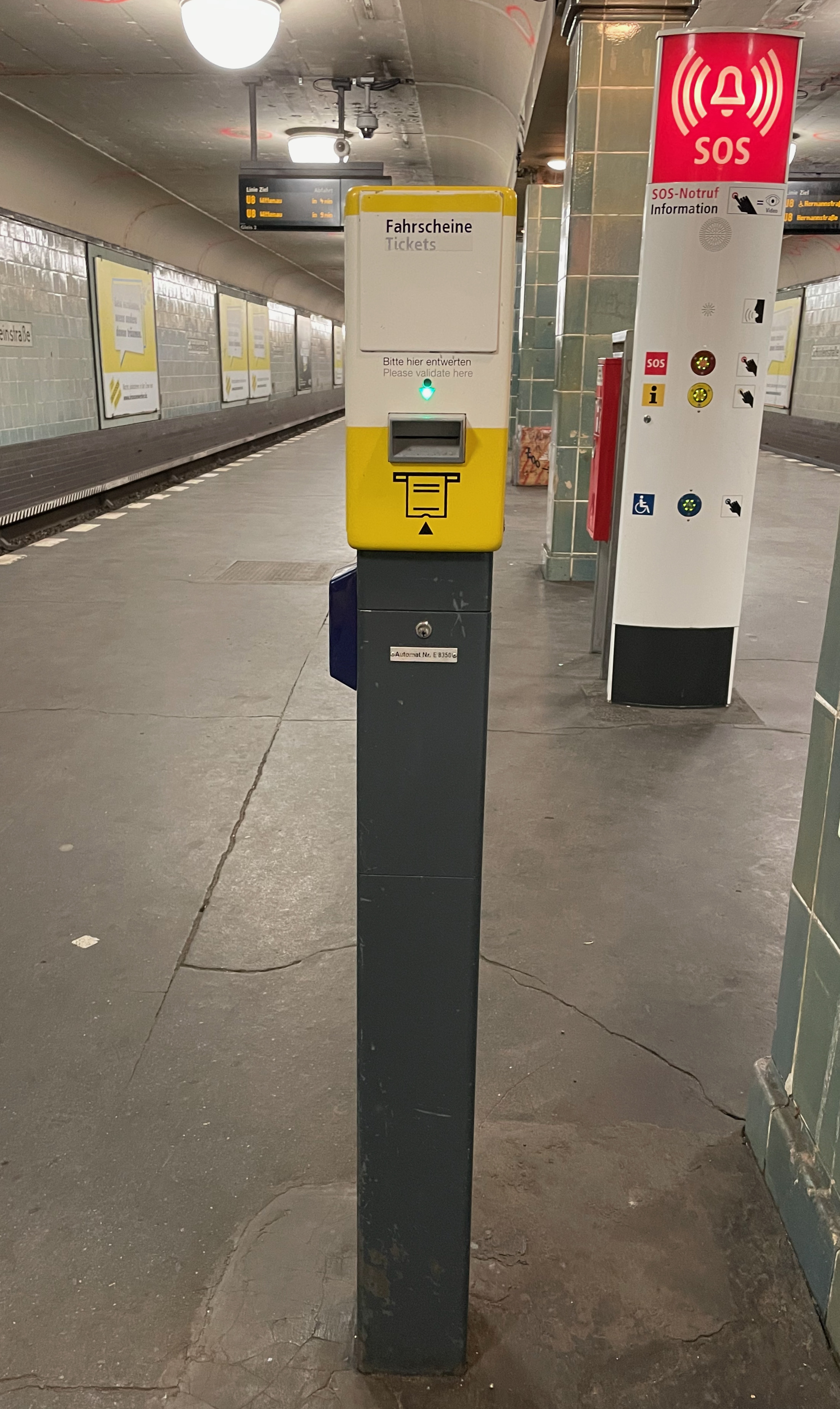
After buying a ticket, you need to validate the ticket at the Entwerter (yellow or red boxes) before riding a train (or after boarding a bus if the ticket is not already validated).
Ticket validating machine at a U-Bahn station
There are no turnstiles for getting on the U-Bahn or S-Bahn.
Daily, Weekly, Monthly, Annual tickets are quite self-explanatory. When buying, you will need to consider both the duration for which you need the ticket and the zones in which you will be traveling. These are the terms you will frequently come across when selecting a ticket.
One Person
Kurzstrecke
Short distance ticket
S/U-Bahn: Maximum three stops, you can change trains (~20 minutes) Bus/Tram: Maximum six stops, no changing allowed
Regular: €2.00
Einzelfahrkarte, Einzelfahrschein
Single trip ticket
Valid for 2 hours
Regular, AB zone: €3.00
Tageskarte
Day ticket
Valid for 24 hours
Regular, AB zone: €8.80
7-Tage-Karte
Weekly ticket
Valid for seven consecutive days
Regular, AB zone: €36.00
Monatskarte
Monthly ticket
Monthly flexible pass
Regular, AB zone: €86.00
Jahreskarten
Annual ticket
Subscription available online
Regular, AB zone: €903.00
Group
Tageskarte, Kleingruppe
Day Ticket, 5 people
Valid for 24 hours
Regular, AB zone: €25.50
You can carry a bicycle only on marked cars of a U-Bahn or S-Bahn and it costs an additional €2.00 in AB zone.
More details about the types of tickets at BVG or VBB.
By Mode of Transport
There are no separate or different tickets for buses or U-Bahn/S-Bahn. With a validated ticket, you can access all modes of public transport: S-Bahn, U-Bahn, buses, and trams.
A validated, single-trip ticket can be used, one per person, across S-Bahn, U-Bahn, and bus if used within 2 hours of purchase “in one direction”. DO NOT USE THE SAME TICKET FOR RETURN JOURNEY.
3. Jelbi – get all features in one app. This is the one I am currently using.
It has a friendly interface. You can choose the language as English.
The first time you add your payment details, the app will make a €1 charge that you will need to approve at your bank or card.
You can check out public transport routes and buy tickets (U, S, Bus, Tram, Ferry). The ticket you buy is validated effective immediately (the 20-minute or 2-hour counter starts right after you buy the ticket).
Using this app, you can even book a car share (license required), scooter share (license required), bike share or book a taxi.
There is a tutorial within the app, but it is in German.
You can register on the app as well as add a payment method. The app will make a €0-1 charge that you will need to approve at your bank or card.
You can set home and work addresses as well as save any other frequented addresses.
You can plan your trip and buy tickets. Mobile tickets are usually valid immediately.
For your trip, the app will suggest the modes of transport available and also tell you the tickets you need to buy for the trip.
You can specify the mode of transport the app should use to suggest a route. For example, you can choose only U-Bahn and S-Bahn and no buses or trams will be suggested for your chosen trip.
You can save future trips and also set an alarm.
Some parts of the app, like the ticket name, are in German.
The coolest feature perhaps is that you can view a live map of the various public transports. You will see the trains and buses move in real-time.
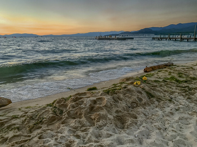
Lake Tahoe is all about beaches. Well, mostly! All you need to do is park yourself at one of them and you’re set for the day/afternoon/evening. In summer months, as everyone flocks to the cool waters of the lake, all beaches and Vista points close to water can get pretty crowded and it can become nearly impossible to get an official/decent parking spot. Some folks do manage to park on the side of the highway and walk miles with their entire beach gear (tents, chairs, food) to their spot of choosing. Probably best to visit Lake Tahoe in an off season to steer clear of the crowd.
While it was a breeze to create an account and generate a GCKey on the http://www.cic.gc.ca/ website (that is the first step), we did face a lot of confusion while collecting the documents we had to submit as part of the process. The website is not always explicit in stating the documents they expect from us, such as for a category called “Purpose of Travel”. We did not want our visa application to get rejected just because we missed submitting something.
We finally made it to the much sought-after Twin Peaks in the most unplanned way. We’ve always been very skeptical about a) driving through the San Francisco city and b) finding a parking spot in the city. So Twin Peaks, which are right in the middle of the city, have always been one of those elusive spots that one can only drive to but seemed inaccessible because of the petty parking problems. After all, the satellite map showed only a handful of legit parking spots between the two peaks.
We started from Bangalore at around 9.15 am, a good two hours behind schedule. All was well as we could still make it to the destination by the check in time; only now we would have to face the Saturday office hour rush. This is the route we took: Old Madras Road – Sarjapur Outer Ring Road – Agara Lake – Silk Board Junction – Jayanagar – Banashankari Bus Stand – METRO – Kanakpura-NICE Junction – NH 209 – Harohally – Left towards Sathnur – Halaguru – Arrive at the destination towards left. ~120 km in 3 hrs, including at least one short stop.
The traffic and roads let us breathe easy only past the Kanakpura-NICE Junction on NH 209. The cool and cloudy weather helped to make it a great drive, at least for as long as we were on NH 209. There were characteristic, yellow road signages at regular intervals indicating the remaining distance and route to the Cauvery Fishing Camp; they were just not there where we needed them the most, though. Past the Kanakpura village and some distance ahead, we luckily spotted the left turn we were supposed to take. We were now off the NH 209 and entered the village areas (Sathnur). The Airtel network gave up on us here.