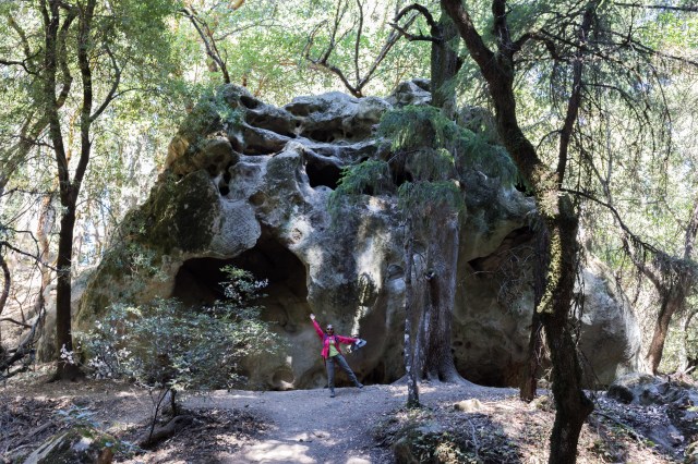
Location: Los Gatos, Santa Clara County
Hike Date: 2015, October 4
Hike Stats: 5.9 miles, 3.5 hours, 2108 feet elevation gain
Repeat Visit: 2017, June 10
Location: Los Gatos, Santa Clara County
Hike Date: 2015, October 4
Hike Stats: 5.9 miles, 3.5 hours, 2108 feet elevation gain
Repeat Visit: 2017, June 10

Hike Date: Saturday, September 12, 2015
4.6 miles, 2 hours, 780 feet
(Repeat visits: Sunday, June 19, 2016 || Saturday, June 24, 2017)
This is our second most-favorite-hike from 2015, the first one being at Big Basin Redwoods State Park. Even though it was a dull, gloomy, gray day, the panoramic views of the Santa Cruz mountains and the vast expanse of forests that stretched out onto the horizon were spellbinding.


Location: Boulder Creek, Santa Cruz County
Hike Date: 2015, September 6, Sunday
* 8.7 miles, 3.5 hours, 2287 feet
* Dool Trail – Sunset Trail – Timms Creek Trail – Skyline-to-the-Sea Trail
Repeat Visit: 2016, July 30, Saturday (Sleep Late and Hike Meetup)
* 9.5 miles, 5.5 hours
* Berry Creek Falls Loop: Dool Trail – Sunset Trail – Berry Creek Falls Trail – Skyline-to-the-Sea Trail – Sunset Trail – Dool Trail


Location: Cupertino, Santa Clara County
Hike Date: 2015, August 29
We were quite late to start with the hike – 5:30 P.M.! To add to the delay, we were unable to find a parking spot close to the trailhead; we drove up and down the Stevens Creek Canyon Rd to find a designated parking place. We finally ended up parking on the side of the road just next to the trailhead.
While driving south the first time, we went past the very scenic Stevens Creek Reservoir. We decided to stop here on our second round and enjoy the panoramic views while there was still ample light.


Hike Date: August 16, 2015
Alum Rock Park is a municipal park in east San Jose; in fact, the first one established in California! The park spans from west to east, snug within the Alum Rock Canyon, and at the foothills of the Diablo Range. One can only imagine how any hike starting from the base of a hill would be like.
The South Rim Trail runs along the southern escarpment of the Alum Rock Canyon. The north and south escarpments of the canyon are characteristically different from each other in foliage – one is almost completely devoid of tree cover (North Rim Trail) and the other provides an excellent cover from the harsh summer sun (South Rim Trail).


Hike Date: August 8, 2015

Though extremely tiring, this hike was one of a kind – a walk along the coast from the northwestern corner of San Francisco to the northeastern point of the city – starting from Sutro Baths and ending at Ghirardelli.

Hike Date: August 1, 2015
4.7 miles, 1.5 hours, 1337 feet
We had paid a leisure visit to the Alum Rock Park in December 2014. At that time, we did not know much about the trail system here. So we had just followed a bunch of other people and strolled on one of the trails that was flanked by a creek. We had been wanting to go back to the Alum Rock Park for some serious hiking, and so we did, in August 2015.


A balloon ride high up in the air — a perfectly memorable and fabulous way to celebrate our tenth wedding anniversary.
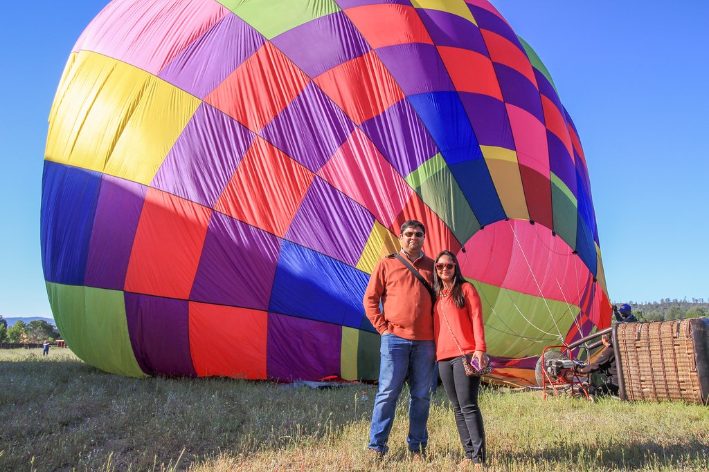
Though the anniversary was in December, the weather in that month was not favorable for this activity. We eventually went for the ride in April 2015.

Hike Date: July 25, 2015

We planned our second hike with a meetup group – Off Peak Hikes & Trips of Silicon Valley. I had been seeing an invite for Almaden Quick Silver County Park hike from this group weekly in my inbox. The group hikes in evenings on Wednesday and in mornings on Saturday. The Saturday morning hike started at 10:30 AM, which was not too early to rush for, so I immediately signed us up for the hike.
Continue reading
Location: Cupertino, Santa Clara County
Loop I: PG&E – Wildcat – Coyote Loop Trail
Hike Date: 2015, July 12
Hike Stats: 3.8 miles, 1.5 hours, 928 feet
Repeat Visit: 2016, May 14 (added the High Meadow Trail to the loop)

(For my other hike in Rancho San Antonio Open Space Preserve, see “Loop II“.)
Continue reading
