Location: San Jose, Santa Clara County
Hike Date: 2020, February 5, Wednesday, 12:00 pm
Hike Stats: 7.3 miles, 3 hours, 1399 feet elevation gain
Gear:
* Shoes: Patagonia Drifter (Vibram)
* Tracking: Garmin Forerunner 235 watch, AllTrails app
* Trekking Poles: Black Diamond Distance Carbon Z
* Hydration Pack: CamelBak Women’s 2016 Day Star 18
TOP
PARKING
There probably are one or two parking spots in the Bernal-Gulnac-Joice Ranch’s parking area but I chose to park on the street on Manila Dr. There is no parking fee at this entrance.
The Pueblo Day Use Area parking lot charges a vehicle entry fee.
RESTROOM
As you enter the Bernal-Gulnac-Joice Ranch Historic Area, there are two restrooms on the left at the entrance. These are concrete structures with pretty good facilities.
TRAILHEAD
There are multiple trailheads to access the park’s trails. Check the park’s official map to see which one works for you.
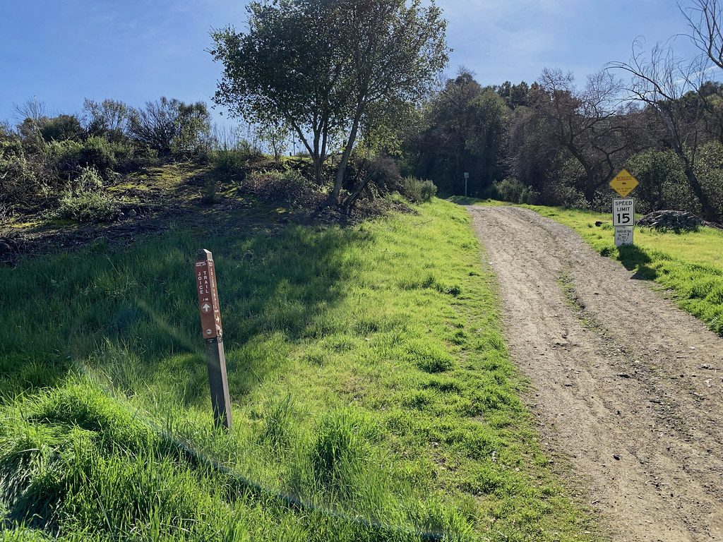
I started the hike at Joice Trail, the northernmost trailhead in this park. This trailhead is located inside the Bernal-Gulnac-Joice Ranch Historic Area on Manila Dr. There are paper maps at this trailhead.
To do the loop described here, you can also start the hike at the Fortini Trail, the southernmost trailhead in the park. There is roadside parking but no restroom at Fortini Trailhead.
EXPOSURE
Mostly exposed, very few parts are shaded.
ABOUT THE PRESERVE
- Santa Teresa County Park is located at the southern end of the Santa Teresa Hills.
- Santa Teresa County Park offers a variety of recreational opportunities: golfing, picnicking, horse riding, hiking, biking, and archery.
- There are no picnic tables or rest stops on the hike route described here.
- Santa Teresa Creek flows for a short distance parallel to the Fortini Trail.
OFFICIAL TRAIL MAP
ABOUT MY HIKE
This was a solo hike. Apart from some folks on the Norred Trail, I did not come across anyone as I went farther and higher.
There is another trailhead on Bernal Rd with a parking lot. I saw a few folks running and hiking here. The Fortini Trail seemed to be more popular among runners and people with dogs. (Fortini Tralhead)
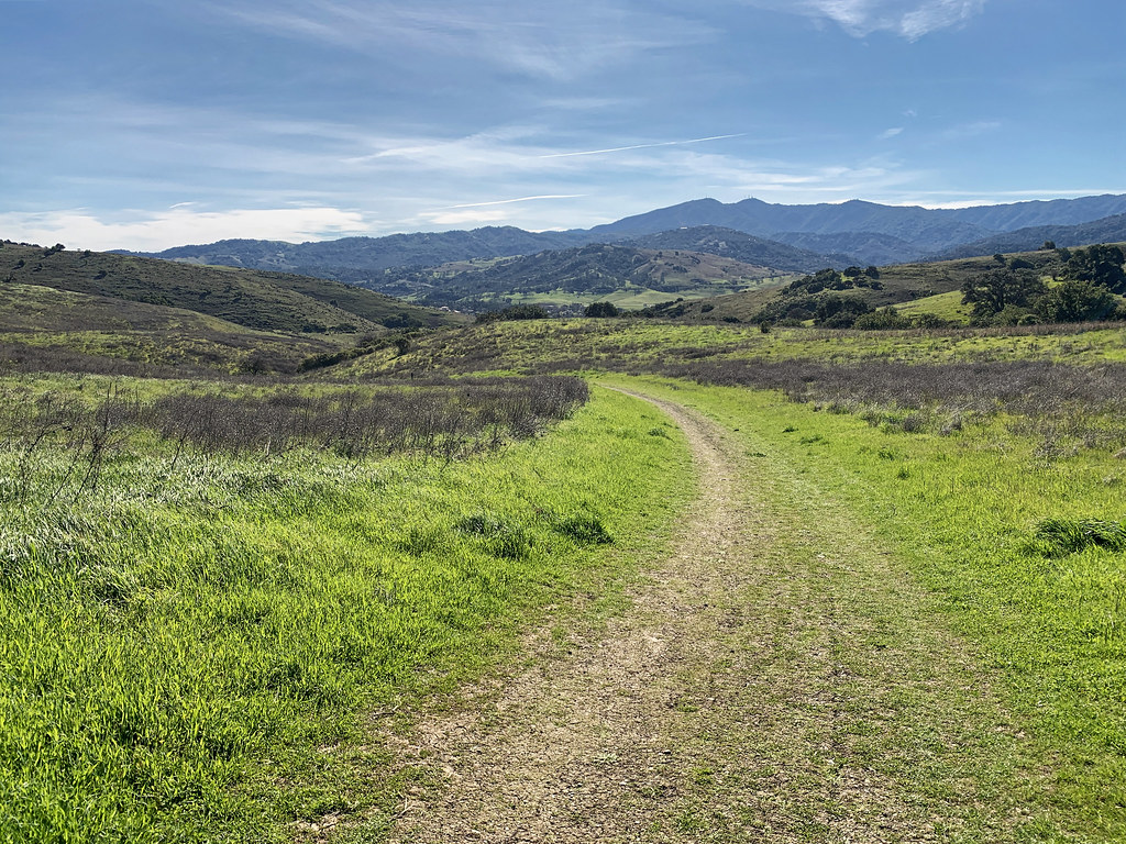
The Stile Ranch Trail was the most desolate. The trail is rugged.
ROUTE SUMMARY
- Type: Loop (Figure-Eight)
- Direction: Clockwise
- Trails and their elevation profile (in feet) over the miles:
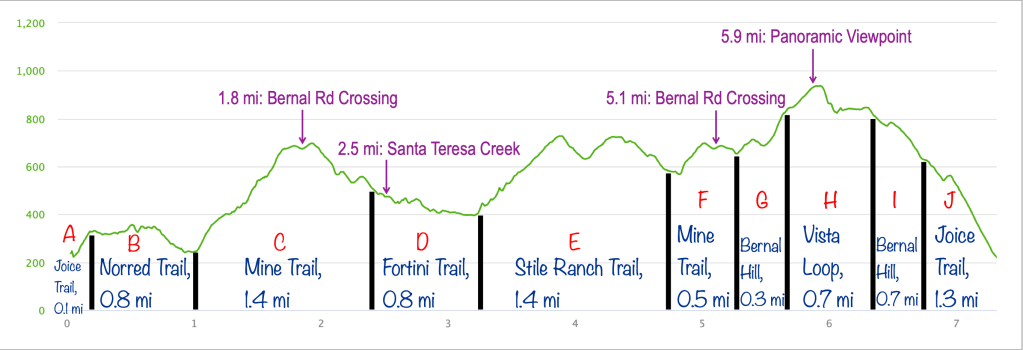
ROUTE MAP (LOOP, CLOCKWISE)
DETAILED ROUTE
- Start the at Trailhead located inside the Bernal-Gulnac-Joice Ranch Historic Area on Manila Dr.
- Take the (A) Joice Trail up the slope.
- You will come across an old ranch equipment on the left.
- Turn left on the T-junction to join the (B) Norred Trail.
- You will come across some old ranch sheds while descending on this trail.
- Turn right at the junction to join the (C) Mine Trail.
- You will come across a trail junction with Bernal Hill Trail on the right but keep going straight on the Mine Trail.
- Cross the Bernal Rd and keep proceeding on the Mine Trail.
- At the fork, stay on the Mine Trail on the left.
- Turn right at the next T-junction to take the (D) Fortini Trail.
- The trail runs parallel to the Santa teresa Creek for a short distance.
- After a while, the trail runs parallel to Fortini Rd and then San Vicente Ave until you arrive at the Fortini Trailhead with roadside parking.
- Take the trail on the right to get on the (E) Stile Ranch Trail.
- This trail is very rugged.
- The trail climbs up swiftly through a couple of switchbacks.
- This trail goes over two hills and a valley in between until you reach the previous fork with Mine Trail.
- Keep to the left to join the (F) Mine Trail.
- Climb the incline, cross the Bernal Rd, and you will arrive at the previous junction with the Bernal Hill Trail.
- Turn left to take the (G) Bernal Hill Trail.
- The next junction you come across will be with the Vista Loop Trail.
- Turn left to start climbing the (H) Vista Loop Trail.
- It goes up and around the hill top and returns back to the previous junction with Bernal Hill Trail.
- Turn left to continue on the (I) Bernal Hill Trail.
- At the T-junction, take the trail on the left to join the (J) Joice Trail that leads you to the starting segment of Joice Trail and back to the Trailhead.
TERRAIN PROFILE (GOOGLE EARTH)

SHOTS FROM THE HIKE