Purisima Creek Redwoods Open Space Preserve

Location: Half Moon Bay, San Mateo County
Hike Date:
2017, August 6, Sunday, 10:50 am
Hike Stats: 7.0 miles, 2.5 hours, 1060 feet elevation gain

Purisima Creek 
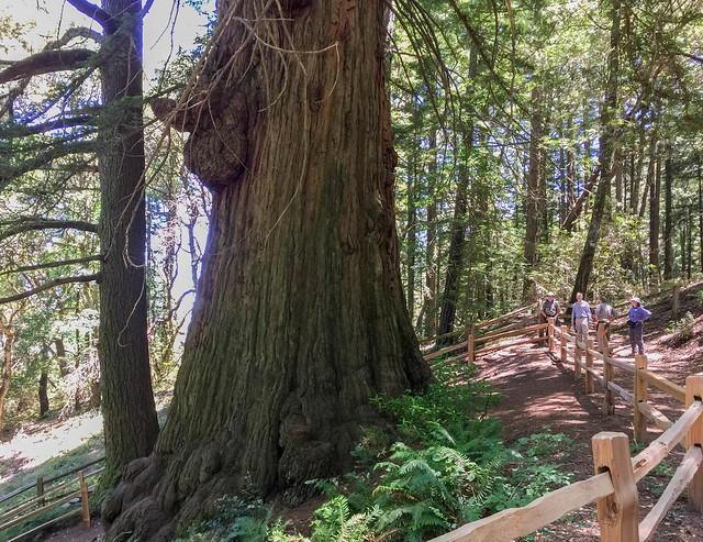
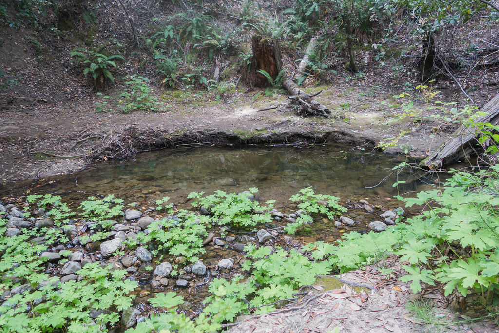
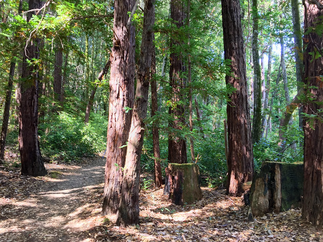
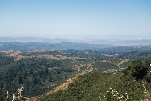
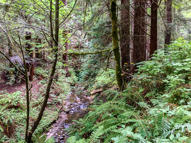
“The centerpiece of this 4,711-acre preserve is Purisima Creek Canyon with its towering redwoods, rushing creek, and an understory of ferns, berries, and wildflowers. Magnificent views of the coast and Half Moon Bay are visible from the northern part of the preserve.” (text source: mrosd)

Continue reading

Wunderlich County Park

Location: Woodside, San Mateo County
Hike Date: 2017, August 12, Wednesday, 10:00 am
Hike Stats: 6.27 miles, 2.5 hours, 1247 feet 

Meadow Trail “Wunderlich Park is a hillside area of redwood forest, open meadows, and beautiful oaks and madrones. This area was donated to the County by Martin Wunderlich. It contains what was once the Folger family ranch, and the estate stable and surrounding buildings have been restored to provide a historic treasure to the community.” (text source: smcgov)

Continue reading

Huddart Park

Location: Woodside, San Mateo County
Hike Date: 2017, July 26, Wednesday, 10:00 am
Hike Stats: 4.44 miles, 1.5 hours, 890 feet

Repeat Visit: 2018, September 2, Sunday

Crystal Springs Trail “With barbecue pits, a playground, grassy meadows, and hiking and riding trails, Huddart Park makes a great place to have a picnic or explore a redwood forest.” (source: smcgov)

Continue reading

Lake Tahoe: Road Trip from San Jose

Ski Run Marina

Lake Tahoe is all about beaches. Well, mostly! All you need to do is park yourself at one of them and you’re set for the day/afternoon/evening. In summer months, as everyone flocks to the cool waters of the lake, all beaches and Vista points close to water can get pretty crowded and it can become nearly impossible to get an official/decent parking spot. Some folks do manage to park on the side of the highway and walk miles with their entire beach gear (tents, chairs, food) to their spot of choosing. Probably best to visit Lake Tahoe in an off season to steer clear of the crowd.

Continue reading

La Honda Creek Open Space Preserve

Location: Redwood City, San Mateo County
Hike Date: 2017, June 21, Wednesday, 10:40 am
Hike Stats: 3.3 miles, 1.5 hours, 400 feet elevation gain

View at the Vista Point “The panoramic view of the seemingly never-ending valleys leading to the coast is spectacular. On a clear day, visibility extends to the ocean.” (text source: mrosd)

Continue reading

Smartphone App for Hiking in the Midpeninsula Region – Avenza Maps

Avenza MapsOn one of the docent-led hikes, I learned that I need not rely on Google Maps for figuring out my route in the middle of a forest. Thanks to Marie-Anne Neimat, a docent, for introducing me to Avenza Maps (free) – a great app for hiking in the Bay Area Peninsula region. The app is available both for Android and iOS. The app uses the GPS on your phone to help you track your hiking route as well as tell you which trail you’re at.

Midpeninsula Regional Open Space District (MROSD) provides free GeoPDF maps for some of the preserves (look for Midpen Preserves (Bundle) in the app’s Store).

More information about the app is available on the MROSD website.

El Corte de Madera Creek Open Space Preserve

Location: Redwood City, San Mateo County
Hike Date: 2017, June 28, Wednesday, 10:10 am
Hike Stats: 6.4 miles, 2.5 hours, 1375 feet elevation gain

Repeat Visit: 2019, May 4, Saturday

Methuselah Tree “The panoramic view of the seemingly never-ending valleys leading to the coast is spectacular. On a clear day, visibility extends to the ocean.” (text source: mrosd)

Continue reading

Castle Rock State Park, Saratoga Gap Trail

Location: Los Gatos, Santa Clara County
Hike Date: 2017, June 10, Saturday
Hike Stats
: 5.4 miles, 4 hours, 1700 feet

Previous Visit: 2015, October 4, Sunday

One of the Sandstone Outcrops on the Saratoga Gap Trail

Exquisite sandstone formations and sculpted caves are among the treasured features within this park’s vast wilderness.


For my previous trip to this state park in 2015, check out this post.
For other trails in Castle Rock State Park, check out this post on Skyline to the Sea Trail.

Continue reading

Castle Rock State Park, Skyline-to-the-Sea Trail

Location: Los Gatos, Santa Clara County
Hike Date: 2017, June 1, Thursday
Hike Stats:
5.33 miles, 2 hours 25 minutes, 1079 feet elevation gain

Summit Meadow Trail

Attractive lichen-covered boulders and sandstone rock outcrops add to the scenic value of this area.


For other routes in Castle Rock State Park, see Hike in Castle Rock State Park – Saratoga Gap Trail.

Continue reading